Costa Blanca Walking routes .The nature is very beautiful at the Costa Blanca. So it is natural that they are several walking route has been set up.
The Trans Alicante walking route
Indeed, that is a long distance walking route. When you walk this route, you cross the whole Alicante province.
The walking routs is in total 430 kilometers long.
It is normal that you cross all sort of countryside. You can admire the natural beauty of the Costa Blanca. But also the many natural parks. with even bird protection zones.
Furthermore the GR 330 take you to castles, historic building and little villages.So it is also a cultural walk enjoining the Spanish heritage.
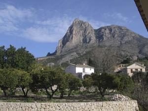
The ” Gran Ruta de Costa Blanca” leads you to the Montcabrer , Sierra de Aitana and Puig Campana.
Also important is that there are local short distance routes allowing the walkers to do the circular trips.
Information about the Great Route
There are leaflets and maps at the tourist office around the Alicante province.
Also at tourism fairs you can find information.
But it is only in Spanish.
In the future the leaflets and maps will be available also in English , French and German.
Furthermore you can download the walking route via internet. Wikiloc is the place : Gran Ruta Interior.
Bullas – Caravaca Costa Blanca Walking routes
This walking route is a part of the Camino de la Cruz de Caravaca.
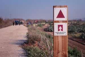
It is a perfect way to discover the Region of Murcia.
You find a date with the history. Caravaca de la Cruz is a meeting point for Christianity. Like Rome, Jerusalem, Santiago de Compostela.
The inland part is delightful.
The walking route takes you trough spectacular scenery. So this walking day give you a good feel for the area . There is much to see.
Bullas has a wine museum and many bodegas to visit. Furthermore the town is situated in fertile plain and has been a wine-producing area since the Romans.
Because Cegehin is crammed on the side of a hill , the town is a delight.With a walk trough the old quarter center with the narrow streets . It is been declared of Historical Artistically interest ( National Treasure ) .To sum up : there is an old palace to visit, a Casino, the town hall and a very beautiful “Plaza del Castillo “.
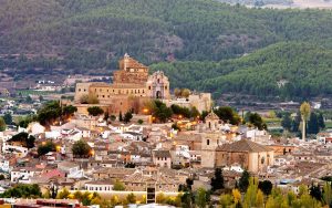
Carava de la cruz is a very nice city to visit .
It is well-known in Spain for his celebration of the Horse Wine races. This event is declared by the Unesco as Cultural Heritage of Humanity.Read more about this event on our page Wine horses races of Murcia .
Caravaca de la cruz is dominated by the Castilo of Santa Cruz.
The city is full of monuments, plaza and museums.For the Spanish people Caravaca is a popular tourist attraction. There is a miraculous cross , for the believers with healing powers.
Distance : 21 km
time : 5 hours
The “Vivas Verdes” walking route .
The vivas verde is a walking route that runs along the old Caravaca de la Cruz- Murcia railway. In the past , in 1971 the railway was closed.
The length is 48 km.So it is also very popular as cycling route .
If you are also a cycling fan see also our page on cycling in the Costa Blanca.
Distance: 48 km
Time: 8 hours
Time with the bike : 2 hours
The Sierra Helada walking route
A fantastic walking tour is the one of the Sierra Helada.
You can admire fantastic views on the summit of the mountain Helada.
Sierra Helada means Frozen mountains in Spanish
Fantastic views can be seen on the summit of Helada. From this point you can see the Mediterranean Sea with beautiful coves
Further away there are the tower blocks of Benidorm.
Most walkers starts from the Albir beach. There you can leave your car at the parking.
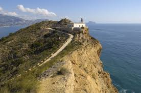
The route to the summit passes at the ancient mines and of course the lighthouse of Albir.
You can easily follow the track
Some say that from the repeater masts the cliff track least you just above ” Mundomar ” Mundomar is one of the famous water parks in Benidorm with dolphins.
So at the right place and hour you can see a dolphin show.
It is a moderate walk.
Distance is 7 km.
Duration : count a 4:30 hours
Costa Blanca Walking routes :The Guadalest Embalse
First, this walk is pleasant in any season and weather. A Embalse is a dam in Spanish.
So, it provides beautiful blue-green water for the nature lovers. And of course, very important water for the residents.
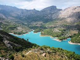
So, the walking route starts from the dam of the embalse of Guadalest in an against the clock direction.
In the village of Benardia you already can make a stop for a drink or tapa.
Then, you can descend from this little village and follow the south track back to the Guadalest dam.
Length : 12 km
duration 4 hrs
Ascent 228 meters
Ornithology walking route in La Manga
This path is new . It runs from the Mar Menor ( inside sea nearby Murcia) to the Mediterranean Sea at the end of La manga .
Till now, tourist know La Manga del Mar Menor as a popular holiday destination.
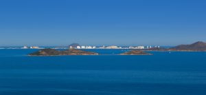
But La Manga is special, because of its unique location in Southern Spain.
It is special in terms of its geographic and environment.
So the government is also aware of it.
They want to attract also tourist who like the nature and like to walk.
The North of the strip of La Manga is not so full built as the rest of the nearly island.
So is the home of many kinds of seagulls, several sort of ducks and many more.
There is a wealth of bird life in this region.
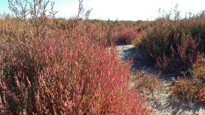
So, in the future there will be a walkway from the end of La manga along the channels which connects the two seas.
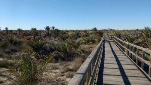
Of course information boards will be installed along the walking path. With explication about the local fauna and flora.
In the future, the government will make the link from La manga to San Pedro del Pinitar by a similar walkway
Costa Blanca Walking routes
There are many more routes to discover at the Costa Blanca.
So follow us.